GPS Angular Camera App Overview
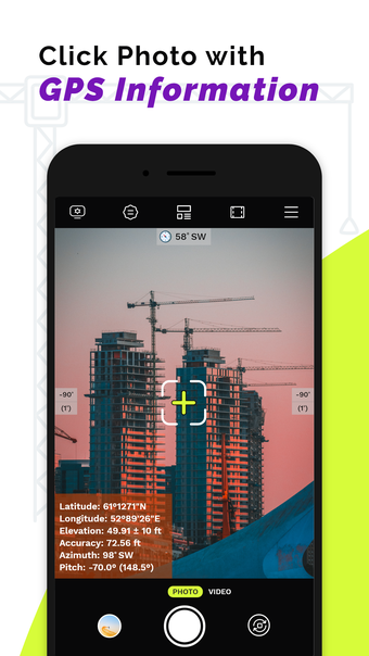
GPS Angular Camera App is a versatile geotagging application that offers a unique combination of features including date timestamp, latitude and longitude tagging, pitch angle measurement, customizable notes, azimuth and altitude details for both photos and live videos. It serves various purposes such as generating work reports for construction sites, land surveys, deliveries, and fieldwork tasks. Professionals in navigation, astronomy, engineering, mapping, and mining can benefit significantly from its capabilities.
This app simplifies the process for individuals working in the field by providing easy measurement of pitch angle, azimuth, and altitude at their current location using their smartphone camera. It automatically adds watermarks of angular timestamp, pitch angle, and azimuth to images, making it a comprehensive tool for on-the-go data collection.